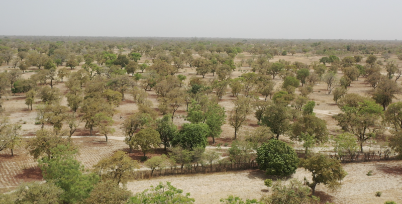


Earlier this year Sustain Sahel project coordinator, Harun Cicek, visited Western Africa to begin the identification and selection process for the field trial sites across Western Sahel. The aim of the trip was to map and procure better quality imagery of potential trial sites across Senegal, Mali and Burkina Faso using drones.
Harun explains: “We took drone images so that we can identify the tree, shrub and cropping patterns, with more than 4500 arial images taken of several fields across the three countries.”
These images are being ‘stitched’ together to produce a detailed picture of 3-to-5-hectare field areas which will provide vital information to the Sustain Sahel project. By identifying the current tree, shrub and cropping patterns in the proposed project focus areas, partners will be able to begin developing interventions and support systems that improve the integration of shrub, crop and livestock farming methods.
Harun, expressing the importance of this visit, says: “These high-resolution images will help us to detect the current layout of the species and design interventions. For instance, by knowing the type of species, their density and distribution within an area, we will be in a better position to propose experimental design and relevant interventions.”
 tap and then scroll down to the Add to Home Screen command.